International Journal of Applied Science and Engineering
Published by Chaoyang University of Technology

Ming-Chih Lin, Yu-Ming Kang, Kun-Fa Lee1 and Hui-Chi Hsu

Civil and Hydraulic Engineering, Feng Chia University No. 100 Wenhwa Rd., Seatwen, Taichung, Taiwan 40724, R.O.C.


Download Citation: |
Download PDF


ABSTRACT


Under the massive compression forces from three major tectonic plates (Fig. 1), the geotectonic structure of Taiwan is characterized more by tall steep mountains than by flat lands. For this reason, underground water often flows directly from rivers into the sea, rather than being collected by reservoirs, a feature which contributes to the meager underground water resource. Furthermore, since most flatlands are formed by loose alluvium, and free underground water nearer the surface often rises during the rainy season, while the stratum in mountainous areas are commonly characterized by discontinuity (plane) and broken rock soil, this makings for a relatively complex underground water path. In terms of underground water site investigations, the drilling method commonly adopted is both labor intensive and material consumptive.  
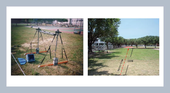
The aim of this study was to investigate the feasibility of detecting underground water level by using GPR (Ground-Penetrating Radar). A vacant land adjacent to the playground of an elementary school in Miaoli City was used as the experimental site, and tested with the SIR-2 mainframe and 80MHz antenna developed by GSSI (USA), according to the CDP seismic method. From the data compiled and images generated thereby, this study found the underground water level approximately between 11m to 16m underground. Thus, GPR has proven to be an effective detection method for underground water level, and can serve as reference for future applications.


Keywords: Ground-Penetrating Radar (GPR); Underground Water; Common Depth Point (CDP); Tectonic.


Share this article with your colleagues


REFERENCES


  1. [1] Tronicke, J., Blindown., Grossr. Lan- ge, M. A., 1999. Joint application of surface electrical resistivity- and GPR- measurements for groundwater exploration on the island of Spiekeroog- northern German, Journal of hydrology, 223,  1-2: 44-53 .

  2. [2] Sato, M., and Lu, Q., 2002. Ground water migration monitoring by GPR, Geoscience and Remote Sensing Symposium, 1: 345 - 347.

  3. [3] Nakashima, Y., Zhou, H., and Sato, M., 2001. Estimation of groundwater level by GPR in an area with multiple ambiguous reflections”, Journal of Applied Geophysics, 47, 3-4: 241-249.

  4. [4] Jandyr de Menezes Travassosa, Paulo de Tarso Luiz Menezesb, 2004. GPR exploration for groundwater in a crystalline rock terrain, Journal of Applied Geophysics 55: 239– 248.
     
  5. [5] Topp, G. C., Davis, J. L., and Annan, A. P., 1980. Electro-magnetic determination of soil water content: measurement in coaxial transmission lines, Water Resources, Res. 16: 574-586.

  6. [6] Shih, S. F., and Doolittle, J. A., 1984. Using radar to investigate organic thic- kness in the Florida everglades, Soil Science Society of America Journal, 48, 3: 651-656.

  7. [7] Liang, S. 1990. Principles of GPR echo wave and application on testing underground water level, Journal of Agriculture and Forestry, 39, 2: 201-219.

  8. [8] Beres, M. J. and Haeni, E. P., 1991. Application of ground-penetrating -radar methods in hydrogeologic studies, Ground Water, 29, 3: 375-386.

  9. [9] Yang, C. H., and Liao, K. C., 1994. GPR survey and applications, Geology, 14, 2: 115 -118.

  10. [10] Chou, C. K., 1994. A study of GPR on underground water survey, Master thesis for Institute of Applied Geology, National Central University, Taoyuan.

  11. [11] Lee, K. T., 1996. “Initial study of GPR applications on civil engineering”, Master thesis for Institute of Civil Engineering, National Cheng Kung University.

  12. [12] Chou, C. K., 1994. “A study of GPR on underground water survey”, Master thesis for Institute of Applied Geology, National Central University, Taoyuan.

  13. [13] Lee, K. T., 1996. “Initial study of GPR applications on civil engineering”, Master thesis for Institute of Civil Engineering, National Cheng Kung University.

  14. [14] Daniels, J. J., 1994. “Ground penetrating radar for geo-technical applications, Geophysical Characterization of Sites”, Volume Prepared by ISSMFE, TC #10:1-13.

  15. [15] Dominic, D. F., 1995. Delineation of shallow stratigraphy using ground- penetrating radar, Journal of Applied Geophysics, 33, 1-3: 167-176. 

  16. [16] Benson, A. K., 1993. Case studies using  ground penetrating radar to help assess  groundwater contamination, shallow  faulting, faults, and cavities, Proceeding  of the 29th Symposium on Engineering  Geology and Geotechnical Engineering, Idaho State University, Rena, NV: 63-89.


ARTICLE INFORMATION


Accepted: 2009-08-19
Available Online: 2009-10-01


Cite this article:

Lin, M.-C., Kang, Y.-M., Lee, K.-F., Hsu, H.-C. 2009. A study on the technologies for detecting underground water level and processing image. International Journal of Applied Science and Engineering, 7, 61–68. https://doi.org/10.6703/IJASE.2009.7(1).61